SEGMENTED MAP VIEWS
Selected photos from the photo library can be viewed in several map views:
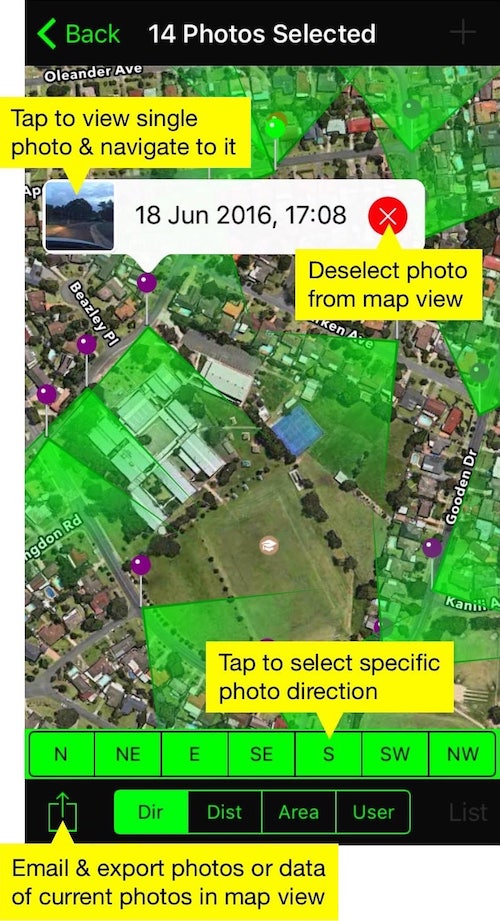
Direction:
View cardinal and inter-cardinal directions of the selected photos. You can also see one direction of photos taken, i.e. North or South East.

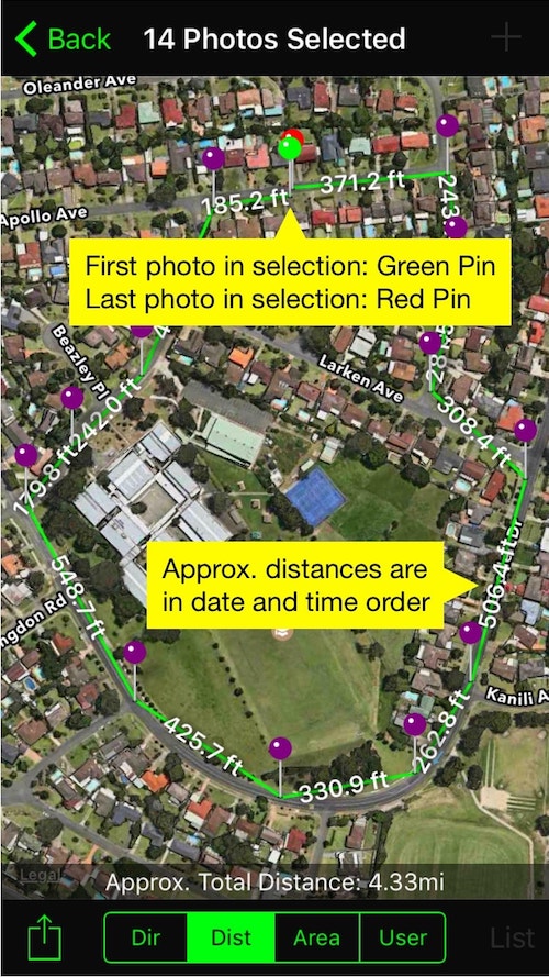
Distance:
This view shows the distance between photos taken within date/time order.

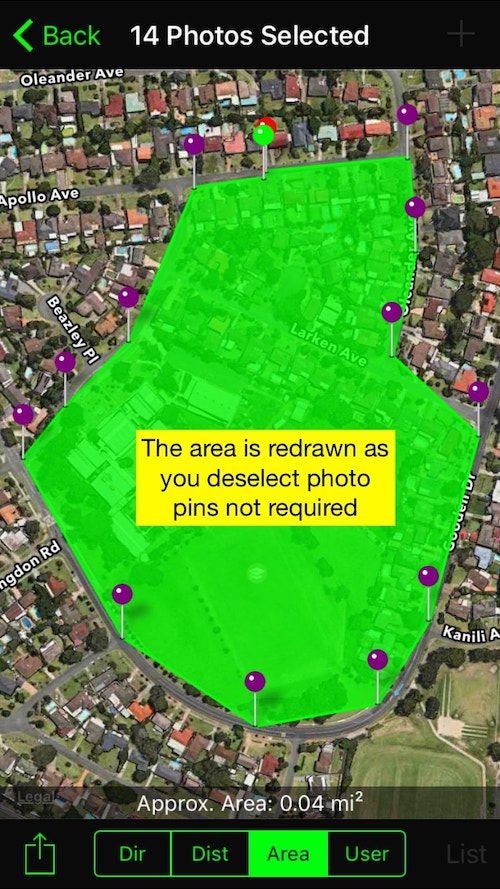
Area:
View the area where selected photos were taken.

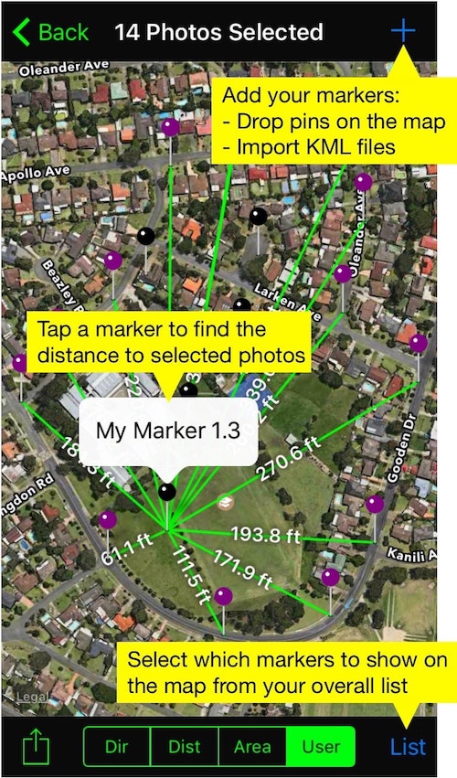
User-Defined:
This view shows the distance from your markers, either dropped onto the map or from a downloaded KML file from Dropbox or Google Drive. When you tap onto a marker you’ve added, it shows the distance to each selected photo, helping you see which photo is closest or a certain distance away from the marker you tapped.

