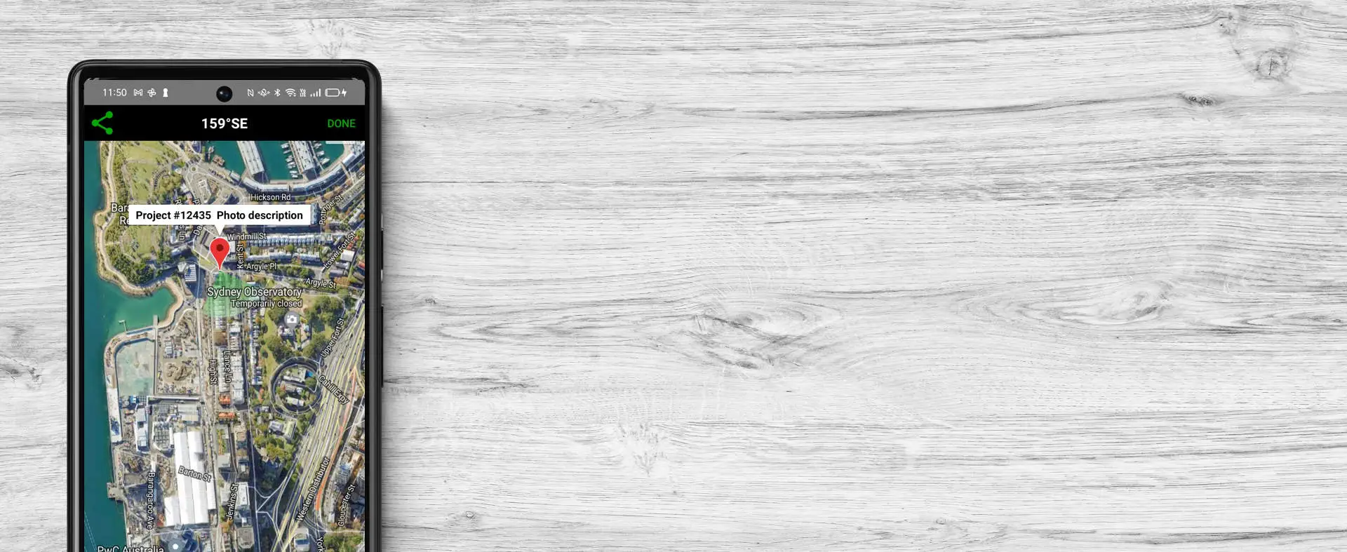
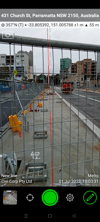
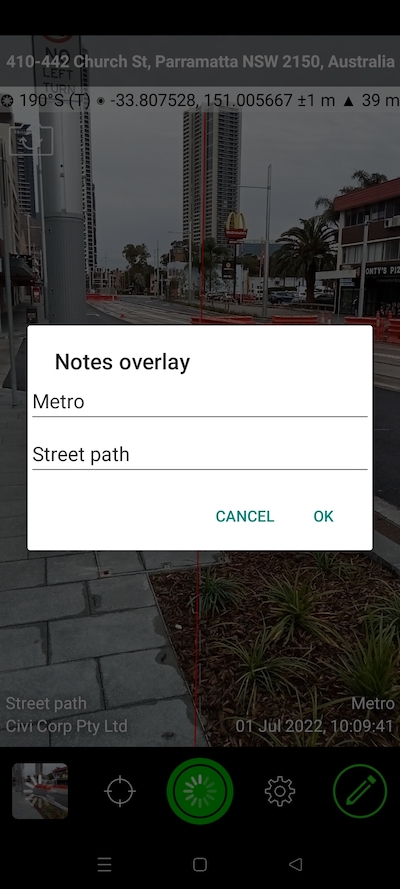
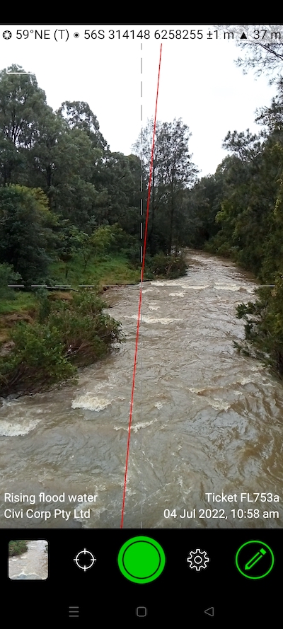
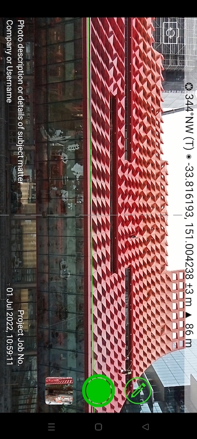
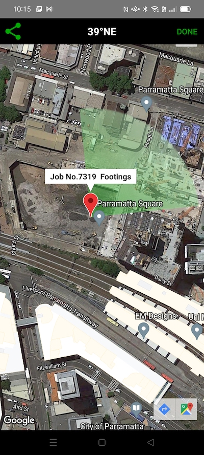
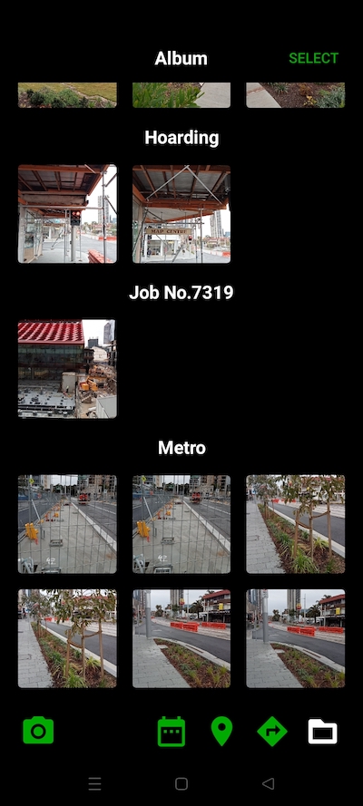
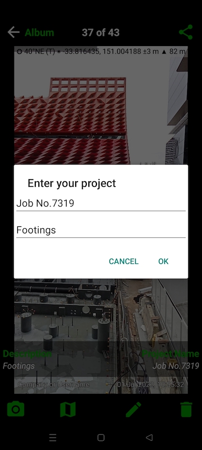
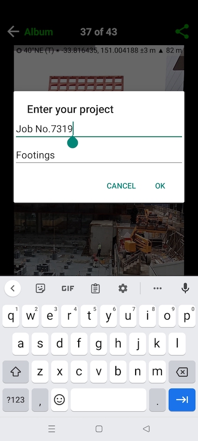
project name & description of photo location in solocator android map

Android Features

OVERLAYS

CAMERA

AUTOSAVE PHOTOS

MANAGE PHOTOS

SHARE PHOTOS

OVERLAYS

STANDARD
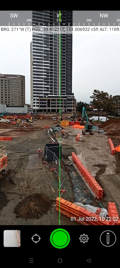
  • Construction site with compass and geo coordinates overlaid.
  • Excavator on construction site with date, time and location overlays.
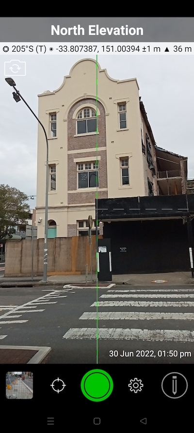
  • Street crossing in front of a North facing building.
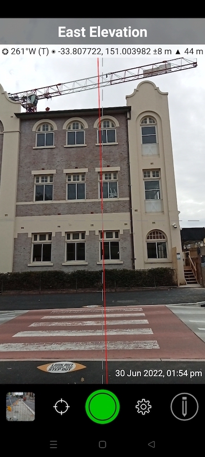
  • East elevation of building with crane in the background.
  • CAPTURE INFORMATION FOR PROOF
    Select the information you want to overlay on the photos you take for your work or documentation for proof:

    • GPS Location (Latitude & Longitude in various formats) ± Accuracy
    • Compass direction – bearing (True/Magnetic North)
    • Altitude (Metric & Imperial units)
    • Local date & time
    • Show compass
    • Show cardinal direction in Building mode, e.g. North elevation of a building face.
    • Option to use abbreviations or Unicode characters for direction, position and altitude.
    INDUSTRY PACK
  • Safety fences around road works.
  • Notes overlay fields in Solocator Android app.
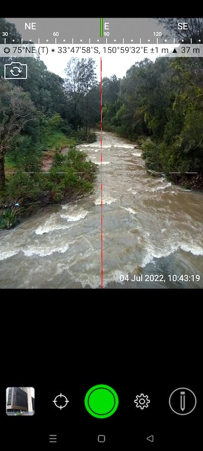
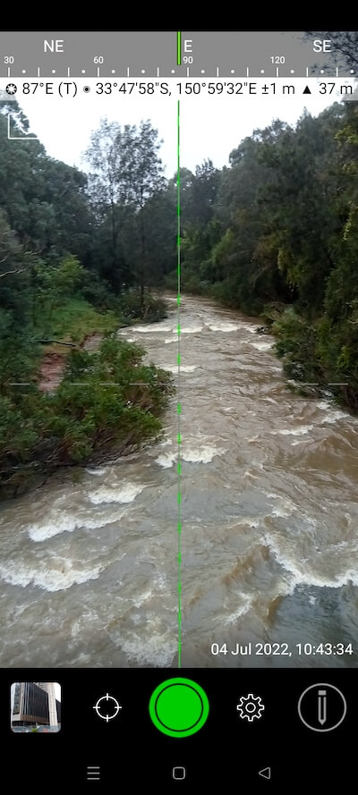
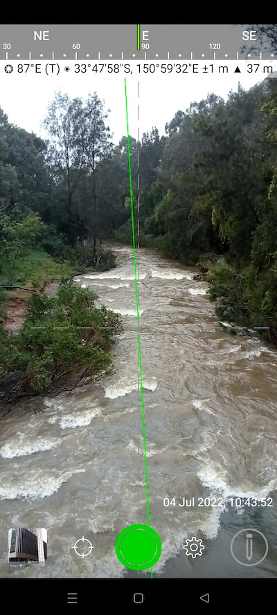
  • Flooded creek.
  • Landscape photo of building with red roof with a selection of overlaid information.
  • EDITABLE NOTES OVERLAY
    Stamp your photos with “Project name”, “Description”, & “Watermark”. The Project name field is designed to be used as a job or ticket/policy number, which can also be used for creating folders when autosaving photos to the cloud. The description field helps to define further details about the photos, and the Watermark field is typically used for company or user names. You can also edit the Project Name, Description or Watermark fields later.

    STREET MODE
    Selecting street mode overlays photos with the street address. You can select at what distance interval to check and update the street address when on the go.

    REFINE AND LOCK GPS LOCATION
    Ideal for those working in and around buildings; to improve your GPS location. The GPS info bar turns green when in the lock position, indicating your position is fixed.

    SWITCH OFF CAPTURE MODES – GREATER FLEXIBILITY
    Switch Compass, Building and Street modes off and only show the GPS info bar on top of photos. It gives you more flexibility on how you overlay info and show more of the image.

    UTM & MGRS Coordinate Formats

    CAMERA

    STANDARD
  • Solocator gps camera in 4x3 aspect ratio.
  • Solocator gps camera in 16x9 aspect ratio.
  • Solocator gps camera in 2x1 aspect ratio.
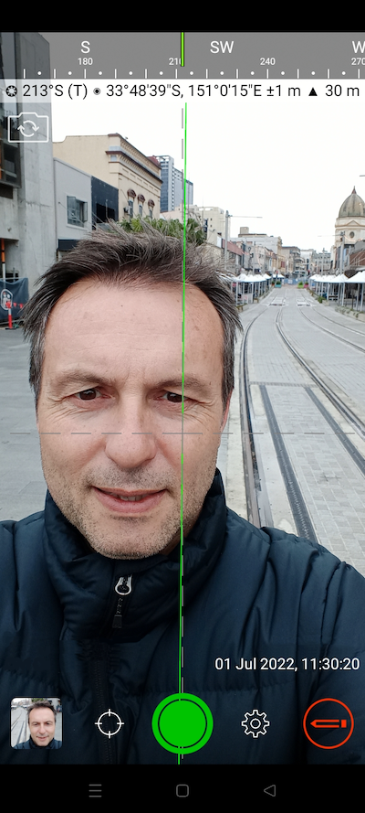
  • Selfie camera in Solocator Android app.
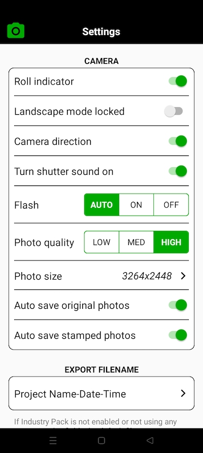
  • TAKE TWO PHOTOS AT ONCE, One photo with the stamped GPS overlay info and the other a full-resolution original photo of the same shot. By default, both photos are autosaved to your device’s camera roll. The stamped photos are also saved into the Solocator photo library for further editing or export options. Autosaving photos to your camera roll can be turned on or off for either original or stamped photos.

    PHOTO SIZES that the Solocator Android camera calls up are based on your Android device. Typically photo aspect sizes are 4:3, 16:9 and 2:1. See photo examples

    SELFIE CAMERA on Solocator allows the same overlays to be stamped with the direction of photos taken towards you.

    Other General Camera functions include pinch zoom, auto, manual and lock Focus/Exposure plus Flash (auto | on | off).

    LANDSCAPE LOCK – Ideal for taking photos towards the ground.

    INDUSTRY PACK
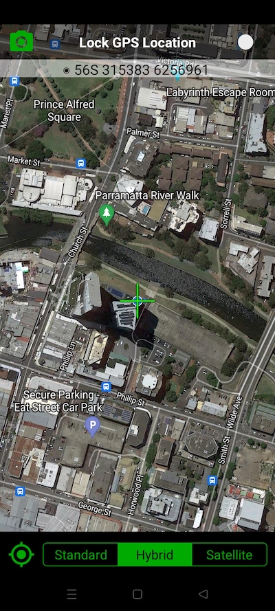
  • Crosshair showing current position in Solocator map.
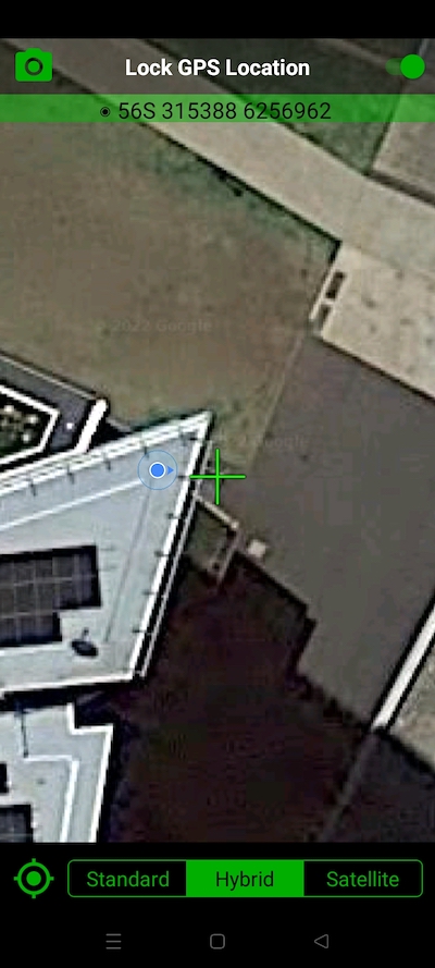
  • Crosshair locked in position next to building.
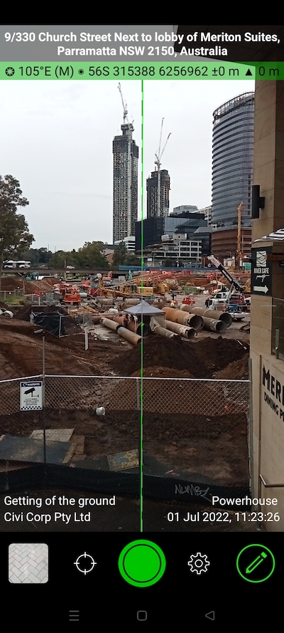
  • Civi works on a major construction site.
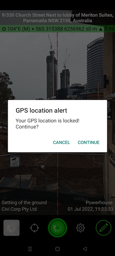
  • Alert reminding Solocator app user their location is currently locked.
  • LOCK GPS POSITION

    • When taking photos under cover or up against large buildings, you may wish to refine and lock your position to identify your position better, especially if there are structures to compare to.
    • This feature may also be helpful for you if you want to nominate the position of the asset, building etc., you’re taking a photo or instead of where you’re standing.

    GPS info bar in the camera overlay turns green, indicating the change from live GPS roaming (white background), and an alert pops up after the shutter button is used to remind you that your position is fixed.

    AUTOSAVE PHOTOS

    STANDARD
  • Solocator Android settings screen.
  • AUTOSAVE PHOTOS TO DEVICE CAMERA ROLL
    Take and autosave two photos at once to the device camera roll:

    • Stamped photo with overlays and
    • Original high res photo with no stamped overlays
    INDUSTRY PACK

    AUTOSAVE PHOTOS TO CLOUD STORAGE (Coming early 2023)
    Autosave original and stamped photos to:

    • Google Drive
    • Dropbox
    • OneDrive – Personal
    • OneDrive – For Business (includes followed SharePoint Sites and Microsoft Teams)

    Photos can also be saved automatically under date or project name subfolders and autosaving in shared folders.


    MANAGE PHOTOS

    STANDARD
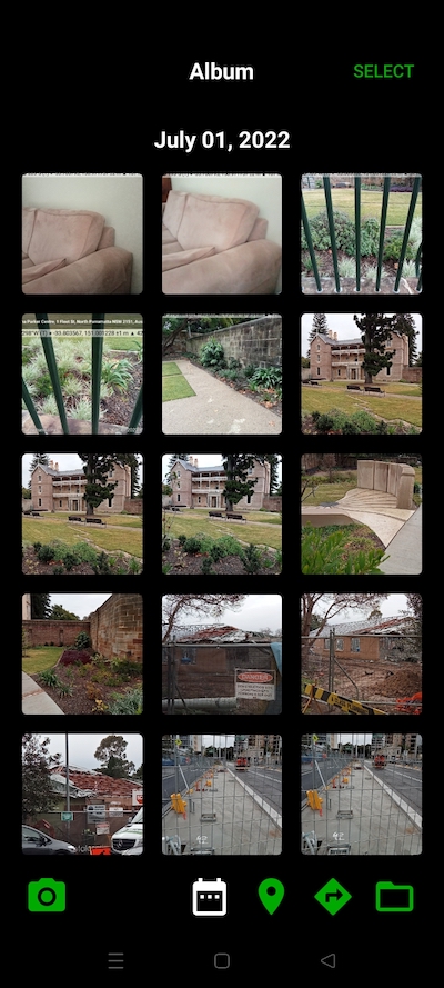
  • Solocator Android photos sorted by date.
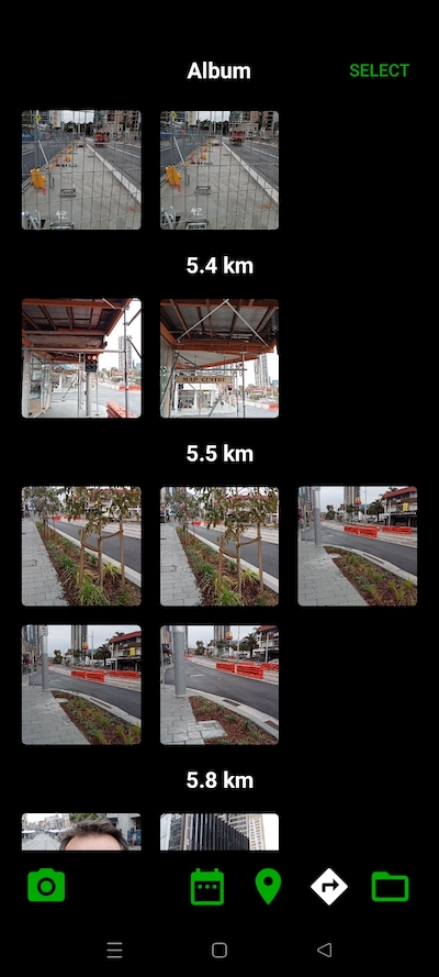
  • Photo library sorted by distance from current location.
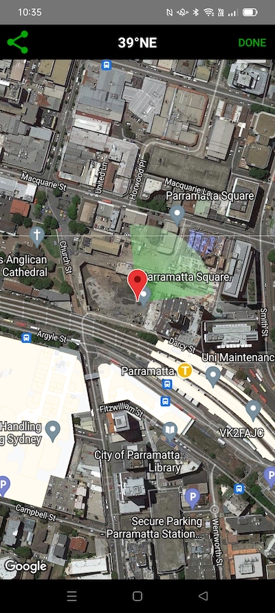
  • Pin and photo fan direction on a map.
  • Location pin name on map with button for directions to.
  • WORKING WITH SOLOCATOR PHOTO LIBRARY

    • Photos are sorted by time, location, distance from current location and by project name (if Industry Pack purchased)
    • View photo direction and location in map view and navigate back there via Google maps.
    INDUSTRY PACK
  • Photo library sorted by projects.
  • Edit notes overlay fields dialog box.
  • Editing notes fields.
  • BATCH EDIT NOTES OVERLAY FIELDS (Coming early 2023)
    Select multiple photos from the library and edit Project Name, Description & Watermark fields in one go. Currently, only the Project Name and Description fields can be edited individually.

    SHARE PHOTOS

    STANDARD
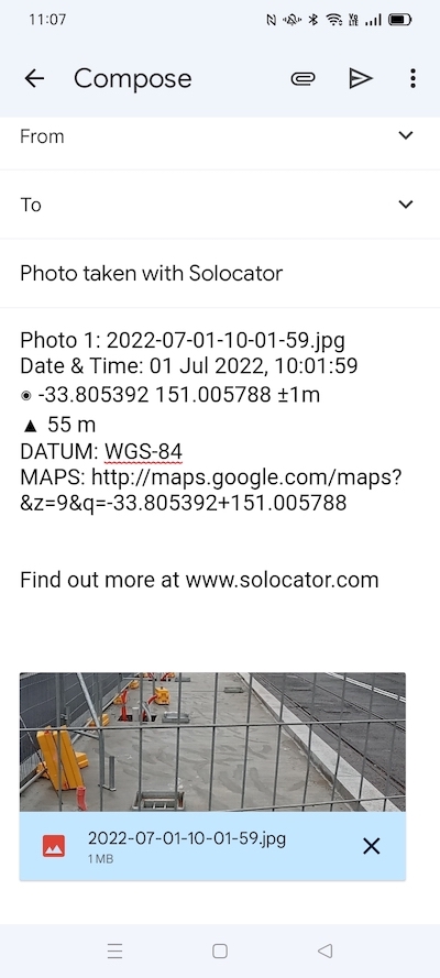
  • Email with Solocator photos and location data.
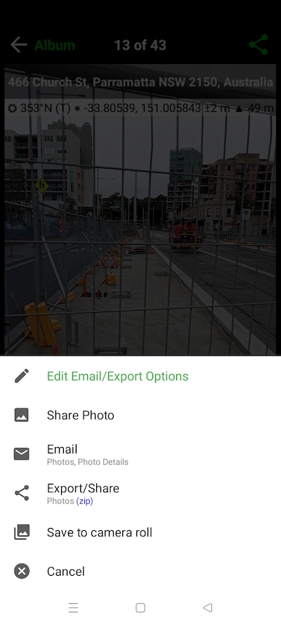
  • Sharing options for Solocator photos.
  • EMAILING PHOTOS & LOCATION DATA

    • Exif metadata saved to photos
    • Photos can be emailed individually or in a zip file
    • Formatted Email Body includes the following photo info:
      • Compass direction
      • GPS position ± accuracy
      • Altitude
      • Date & time taken
      • Street address (Industry Pack)
      • Elevation of building face viewed (if selected)
      • Links to Google maps so the receiver can navigate to the photo location
      • Share photos via the share sheet to other apps
    INDUSTRY PACK
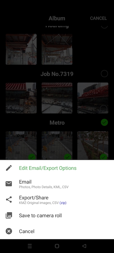
  • Sharing options and customised email and export buttons for Solocator pictures..
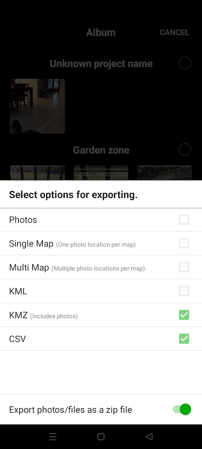
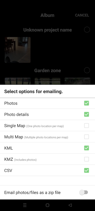
  • Types of files for emailing Solocator pictures.
  • Select from CSV, KML and KMZ files for export with Solocator photos.
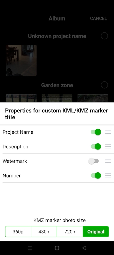
  • Selection list for place mark titles.
  • CUSTOM EXPORTING & EMAILING
    Export or email multiple photos and photo info in KML, KMZ or CSV formats. Attach maps of photo locations along with your photos when exporting or emailing.
    Select your combination of photos, maps and captured info in the file formats to suit your needs — export/email photos individually or as a zip file.
    CustomiseKML/KMZ marker name for exports.

    CUSTOM EXPORT FILENAME
    Define your photo export filename by selecting from the following fields and what order to be used; Project Name, Description, Watermark, Street Address, Date/Time and a Custom field.

    Export/share photos with map links via the share sheet.

    Request a feature

    Contact us and we’ll get back to you as soon as possible

    Contact Us